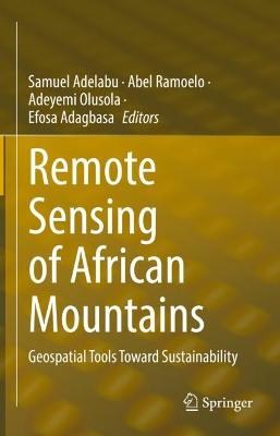
Remote Sensing of African Mountains
 portes grátis
Remote Sensing of African Mountains
Geospatial Tools Toward Sustainability
Ramoelo, Abel; Adelabu, Samuel; Adagbasa, Efosa; Olusola, Adeyemi
Springer International Publishing AG
08/2022
247
Dura
Inglês
9783031048548
15 a 20 dias
576
Descrição não disponível.
Chapter1. Montane grasslands: Biomass estimations using remote sensing techniques and knowledge gap in Africa.- Chapter2. Unravelling regional Geodiversity: a GRID-MAPPING Approach to QUANTIFY GEODIVERSITY in the uThukela District, KwaZulu-Natal.- Chapter3. Monitoring the wildfire activity and ecosystem response on Mt. Kilimanjaro using Earth Observation data and GIS.- Chapter4. Ecological Vulnerability Assessment to Grassland Fires in a Protected Mountainous Area Using Remote Sensing and GIS.- Chapter5. Natural hazards magnitude, vulnerability and recovery strategies in the Rwenzori Mountains, Southwestern Uganda.- Chapter6. Assessing the Vulnerability of the Eastern Africa Highlands' Soils to Rainfall Erosivity.- Chapter7. Development of Lightning Hazard Map for Fire Danger Assessment over Mountainous Protected Area using Geospatial Technology.- Chapter8. Water resources monitoring over the Atlas Mountains in Morocco using satellite observations and Reanalysis data.- Chapter9. Evaluating Settlement Development Change, Pre, and Post-1994 in the Drakensberg Mountains of Afromontane Region, South Africa.- Chapter10. Digital Soil Mapping for hydropedological purposes of the Cathedral Peak research catchments, South Africa.- Chapter11. Effect of Climate Variability and Change on Land Suitability for Irish Potato Production in Kigezi Highlands of Uganda.
Este título pertence ao(s) assunto(s) indicados(s). Para ver outros títulos clique no assunto desejado.
Satellite remote sensing;African mountains;Human-environment interactions;Ecosystem services;Geomorphometry;Mineral exploration;Cryosphere;Climate change
Chapter1. Montane grasslands: Biomass estimations using remote sensing techniques and knowledge gap in Africa.- Chapter2. Unravelling regional Geodiversity: a GRID-MAPPING Approach to QUANTIFY GEODIVERSITY in the uThukela District, KwaZulu-Natal.- Chapter3. Monitoring the wildfire activity and ecosystem response on Mt. Kilimanjaro using Earth Observation data and GIS.- Chapter4. Ecological Vulnerability Assessment to Grassland Fires in a Protected Mountainous Area Using Remote Sensing and GIS.- Chapter5. Natural hazards magnitude, vulnerability and recovery strategies in the Rwenzori Mountains, Southwestern Uganda.- Chapter6. Assessing the Vulnerability of the Eastern Africa Highlands' Soils to Rainfall Erosivity.- Chapter7. Development of Lightning Hazard Map for Fire Danger Assessment over Mountainous Protected Area using Geospatial Technology.- Chapter8. Water resources monitoring over the Atlas Mountains in Morocco using satellite observations and Reanalysis data.- Chapter9. Evaluating Settlement Development Change, Pre, and Post-1994 in the Drakensberg Mountains of Afromontane Region, South Africa.- Chapter10. Digital Soil Mapping for hydropedological purposes of the Cathedral Peak research catchments, South Africa.- Chapter11. Effect of Climate Variability and Change on Land Suitability for Irish Potato Production in Kigezi Highlands of Uganda.
Este título pertence ao(s) assunto(s) indicados(s). Para ver outros títulos clique no assunto desejado.

