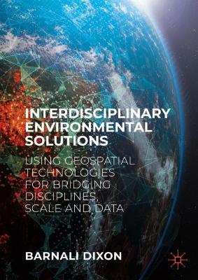
Interdisciplinary Environmental Solutions
 portes grátis
Interdisciplinary Environmental Solutions
Using Geospatial Technologies for Bridging Disciplines, Scale and Data
Dixon, Barnali
Springer International Publishing AG
01/2025
808
Dura
Inglês
9783031167621
Pré-lançamento - envio 15 a 20 dias após a sua edição
Descrição não disponível.
Chapter 1: Introduction Interdisciplinary Environmental Solutions.- Chapter 2:Introduction Complexity of environmental systems.- Chapter 3: Illustration of System Complexity and Need for integrative analysis for effective solutions.- Chapter 4: Place, Space, Scale, Geospatial Analysis and GIS.- Chapter 5: Uncertainty Issues with Complex System.- Chapter 6: Role of Place (Space) in Decision Support Systems.- Chapter 7: Place-based approaches to Integrated Environment Solutions.- Chapter 8: Role of place and space in identification of environmental problems and finding solutions.- Chapter 9: Geographic Problem Solving: Summary of key environmental problems that need integrative approaches and the notion of uncertainty associated with 'ways of knowing'.- Chapter 10: GIS, GeoAI, and Geospatial Framework For Integrated Place-Based Approach.- Chapter 11:Conceptual Framework for Integration of Terrestrial Systems and Aquatic Sinks using Systems Thinking and Place-based Approach.- Chapter 12: Spato-temporal variability of water quality and watershed relationship.- Chapter 13: The Impact of Wildfire on Soil Erosion and Water Quality using a GIS-integrated Framework.- Chapter 14: Geospatially Integrated Drainage Basin Scale Sediment Dynamics Under Projected Future Climate Conditions In South East Georgia, USA.- Chapter 15: Linking Watershed's Properties to MPAs: Integration of Terrestrial Source, Landuse, and Watershed Hydrogeology in Coastal MPA Management.- Chapter 16: Modeling of Surface and Groundwater Contamination to Assess Human Health Risk: An Integrated Geospatial Approach.- Chapter 17: Application of a geospatially integrated species distribution model for seagrass in an urbanized estuary.- Chapter 18: Role of Place/Space in Conservation and Multi-scale Analysis.- Chapter 19: Analyzing Public Responses from Qualitative Data through Spatial Distribution Analysis Utilizing GIS for Effective Resilience Planning.- Chapter 20: Sensitivity Analysis and the use of Geospatial Framework: a Case Study of Soil Moisture and Soil Water Balance.- Chapter 21: Comparison of RUSLE and MUSLE models to predict and estimate soil erosion : a geospatially integrated sensitivity analysis.- Chapter 22: Comparison of Sensitivity analysis with ANN and SVM for Water Budget Calculations.
Este título pertence ao(s) assunto(s) indicados(s). Para ver outros títulos clique no assunto desejado.
interdisciplinary environmental solutions;geospatial technologies;GIS;scale and data;environmental case studies;natural resource management;sustainable environmental planning;spatial modelling and GIS;decision support systems
Chapter 1: Introduction Interdisciplinary Environmental Solutions.- Chapter 2:Introduction Complexity of environmental systems.- Chapter 3: Illustration of System Complexity and Need for integrative analysis for effective solutions.- Chapter 4: Place, Space, Scale, Geospatial Analysis and GIS.- Chapter 5: Uncertainty Issues with Complex System.- Chapter 6: Role of Place (Space) in Decision Support Systems.- Chapter 7: Place-based approaches to Integrated Environment Solutions.- Chapter 8: Role of place and space in identification of environmental problems and finding solutions.- Chapter 9: Geographic Problem Solving: Summary of key environmental problems that need integrative approaches and the notion of uncertainty associated with 'ways of knowing'.- Chapter 10: GIS, GeoAI, and Geospatial Framework For Integrated Place-Based Approach.- Chapter 11:Conceptual Framework for Integration of Terrestrial Systems and Aquatic Sinks using Systems Thinking and Place-based Approach.- Chapter 12: Spato-temporal variability of water quality and watershed relationship.- Chapter 13: The Impact of Wildfire on Soil Erosion and Water Quality using a GIS-integrated Framework.- Chapter 14: Geospatially Integrated Drainage Basin Scale Sediment Dynamics Under Projected Future Climate Conditions In South East Georgia, USA.- Chapter 15: Linking Watershed's Properties to MPAs: Integration of Terrestrial Source, Landuse, and Watershed Hydrogeology in Coastal MPA Management.- Chapter 16: Modeling of Surface and Groundwater Contamination to Assess Human Health Risk: An Integrated Geospatial Approach.- Chapter 17: Application of a geospatially integrated species distribution model for seagrass in an urbanized estuary.- Chapter 18: Role of Place/Space in Conservation and Multi-scale Analysis.- Chapter 19: Analyzing Public Responses from Qualitative Data through Spatial Distribution Analysis Utilizing GIS for Effective Resilience Planning.- Chapter 20: Sensitivity Analysis and the use of Geospatial Framework: a Case Study of Soil Moisture and Soil Water Balance.- Chapter 21: Comparison of RUSLE and MUSLE models to predict and estimate soil erosion : a geospatially integrated sensitivity analysis.- Chapter 22: Comparison of Sensitivity analysis with ANN and SVM for Water Budget Calculations.
Este título pertence ao(s) assunto(s) indicados(s). Para ver outros títulos clique no assunto desejado.


