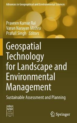
Geospatial Technology for Landscape and Environmental Management
Geospatial Technology for Landscape and Environmental Management

Sustainable Assessment and Planning

Rai, Praveen Kumar; Singh, Prafull; Mishra, Varun Narayan

Springer Verlag, Singapore

01/2023

430

Mole

Inglês

9789811673757

15 a 20 dias

682

Descrição não disponível.
Spatio-temporal variability of channel planform dynamics in response to spatial expansion of brick kilns: a case study of the downstream course of Ichamati River, West Bengal, India.- Assessment of replenishable groundwater resource and integrated water resource planning for sustainable agriculture.- Spatial prediction of flood frequency analysis in a semi-arid zone: A case study from the Seyad basin (Guelmim Region, Morocco).- Geospatial modeling in the assessment of environmental resources for sustainable water resource management in a Gondia district, India.- Hydrochemical characteristics of groundwater-assessment of saltwater intrusion along Krishna Godavari Delta Region, Andhra Pradesh, India.- Micro level planning for integrated natural resources management and sustainable development: an approach through a micro watershed using geospatial technology.- Ecohydrological perspective for environmental degradation of lakes and wetlands in Delhi.- Prioritization and quantitative assessment of Dhundsir Gad using RS and GIS: implications for watershed management, planning and conservation, Garhwal Himalaya, Uttarakhand.- Assessment of groundwater potential zones and resource sustainability through Geospatial Techniques: a case study of Kamina sub-watershed of Bhima River Basin, Maharashtra, India.- Morphometric analysis of Damodar River sub-watershed, Jharkhand, India, using remote sensing and GIS techniques.- The increasing inevitability of IOT in remote disaster monitoring applications.- Countering challenges of smart cities mission through participatory approach.- Urban growth modelling and prediction of land use land cover change over Nagpur city, India using Cellular automata approach.- Slum categorization for efficient development plan - a case study of Udhampur city, J&K using Remote sensing and GIS.- Urban growth trend analysis using Shannon Entropy approach - A case study of Dehradun City of Uttarakhand, India.- Geospatial approach for mapping of significant land use / land cover changes in Andhra Pradesh.- Assessing the impact of Delhi metro network towards urbanization of Delhi-NCR.- Analysis of urban heat island effect in the Rajkot city using Geospatial Techniques.- Multi spectral remote sensing for urban planning and development.- Analysis Of urban green spaces using geospatial techniques-a case study of Vijayawada urban local body Andhra Pradesh, India.- Magnetic susceptibility and heavy metals contamination in agricultural soil of Kopargaon Area, Ahmadnagar District, Maharashtra, India.
Este título pertence ao(s) assunto(s) indicados(s). Para ver outros títulos clique no assunto desejado.
Geospatial technology;Geographic information system (GIS);Natural and cultural landscape;Landscape management and planning;Environmental monitoring and planning;Natural disaster