GIScience for the Sustainable Management of Water Resources
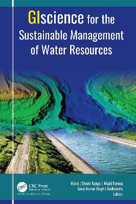
GIScience for the Sustainable Management of Water Resources

Singh, Suraj Kumar; Meraj, Gowhar; Kanga, Shruti; Farooq, Majid; Sudhanshu

Apple Academic Press Inc.

12/2022

408

Dura

Inglês

9781774910481

15 a 20 dias

Descrição não disponível.
PART I: Integrating tools of GIScience for Planning Sustainable Development at Landscape Level 1. Managing Urban Stormwater for Sustainable Urban Development: A Geospatial Approach 2. Remote Sensing and GIS-Based Water Resource Monitoring for Sustainable Crop Intensification and Diversification 3. Using Analytical Hierarchical Process (AHP)-Based Geospatial Approach for Identification of Suitable Sites for Artificial Recharge Structures for Sustainable Water Resource Management 4. Prioritization of Watersheds for Sustainable Water Resource Management at Basin Level Using Remote Sensing and Geographic Information System 5. Use of GI Science for Understanding the Flood and Gully Erosion at Landscape Level 6. Mapping Groundwater Potential Zones Using Satellite Remote Sensing and GIS 7. Evaluating the Watershed Geomorphometry for Assessing Hydrological Response Using GIScience 8. Web-Based Geospatial Approach for Identification of Groundwater Depletion: A Tool for Sustainable Water Resource Management 9. Assessing the Risk of Watersheds to Soil Erosion Using GIScience 10. Sentinel-2 Red-Edge Band as Virus Indicators for Sustainable Wetland Management Assessed During COVID-19 Lockdown PART II: GIScience for Evaluating the Change Dynamics of Earth System Processes 11. Assessing Crop Production Dynamics Using Geospatial Patterns of Soil Moisture, Aridity, and Changing Climate 12. Impact Assessment of Urban Growth on Landscape Dynamics for Sustainable Management Using Geospatial Approach 13. Assessing the Impact of Coastal Morphodynamics on Water Chemistry Using Integrated GIScience and Modeling Approaches 14. Soil Erosion Estimation Using Revised Universal Soil Loss Equation (RUSLE) Model and GIS 15. Analyzing the Degradation of Rivers Using GI Science 16. Evaluating the Glacier Change Dynamics Using GI Science PART III: A Review of the Role of GIScience for Assessing Earth System Processes 17. Application of GIScience for Soil and Water Conservation: A Review 18. Environmental Quality Monitoring Using Environmental Quality Indices (EQI), Geographic Information System (GIS), and Remote Sensing: A Review 19. Groundwater Contamination Control for Sustainable Water Resource Management: A Short Review 20. Assessing the Impact of Urbanization on Deepor Beel: A Review 21. Atmospheric Boundary Layer and Geographic Information System (GIS): A Review
atmospheric boundary layer;Brahmaputra Delta;crop production;environmental quality indices;environmental quality monitoring;flood risk management;geographic information system;GI Science;glacier change;groundwater depletion;Ramsar Wetland Deepor Beel;remote sensing;Revised Universal Soil Loss Equation;satellite remote sensing;soil erosion;sustainable management;urban growth;urban stormwater, water resource