Concepts and Applications of Remote Sensing in Forestry
 portes grátis
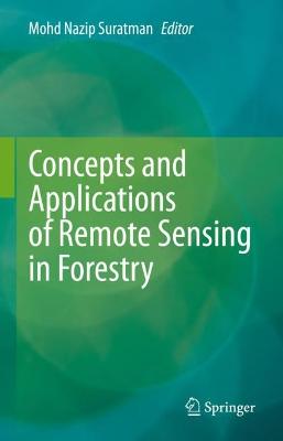
Concepts and Applications of Remote Sensing in Forestry
Suratman, Mohd Nazip
Springer Verlag, Singapore
01/2023
458
Dura
Inglês
9789811941993
15 a 20 dias
875
Descrição não disponível.
1. Remote Sensing for Forest Inventory and Resources Assessment.- 2. Multiple Sensors and Platforms for Biophysical and Biochemical Characterizations of Various Ecosystem Types of Tropical Forests in Malaysia: Advance, Limitation and Opportunity.- 3. A Review on the Use of LiDAR Remote Sensing for Forest Landscape Restoration.- 4. Assessment and Modeling of Forest Biomass and Carbon Stock and Sequestration using Various Remote Sensing Sensor Systems.- 5. Spatial Modeling of Transport and Resources Accessibility for Protecting Forest Ecosystems Against Forest Fires.- 6. Assessment of Forest Aboveground Biomass Estimation from Superview-1 Satellite Image using Machine Learning Approaches.- 7. Floristic Distribution Modelling for Resource Partitioning of Four Native Tree Species in Azad Jammu and Kashmir (AJK), Pakistan using Maxent.- 8. Application of Remote Sensing Vegetation Indices for Forest Cover Assessments.- 9. Rainforest Assessment in Brunei Darussalam through Application of Remote Sensing.- 10. Rubber Trees and Biomass Estimation Using Remote Sensing Technology.- 11. The Use of Landsat TM Imagery for the Application of Rubber Tree Area and Stand Volume Predictive Models in Rubber Plantations in Selangor, Malaysia.- 12. Using Historical Disturbance Identified with LandTrendr in Google Earth Engine for Land Cover Mapping of Oil Palm Landscapes.- 13. Geospatial Technology - Unlocking the Management and Monitoring in Malaysian Mangrove Forests.- 14. Effect of Tidal Regime, Relative Sea Level and Wind Intensity on Changes of Mangrove Area using Remote Sensing Approach.- 15. Spatio-temporal Distribution of Mangrove at Kuala Sepetang Forest Reserve, Malaysia using Remotely-sensed Data.- 16. Determination of The Effect of Urban Forests and Other Green Areas on Surface Temperature in Antalya.- 17. Conceptualising the Citizen-Driven Urban Forest Framework to Improve Local Climate Condition: Geospatial Data Fusion and Numerical Simulation.- 18. State-of-the-Art on Airborne LiDAR Applications in the Field of Forest Engineering.- 19. Restoration of Damaged Forest and Roles of Remote Sensing.- 20. Recent Advances in UAV-based Structure-from-motion Photogrammetry for Aboveground Biomass and Carbon Storage Estimations in Forestry.- 21. Hyperspectral Identification of Selected Dipterocarp Montane at the Species Level.- 22. Tree Biophysical Parameters Retrieval from Multi-source Remote Sensing Data Fusion.
Este título pertence ao(s) assunto(s) indicados(s). Para ver outros títulos clique no assunto desejado.
Remote sensing;Forestry;Recent advancements;Earth observation;Sensors
1. Remote Sensing for Forest Inventory and Resources Assessment.- 2. Multiple Sensors and Platforms for Biophysical and Biochemical Characterizations of Various Ecosystem Types of Tropical Forests in Malaysia: Advance, Limitation and Opportunity.- 3. A Review on the Use of LiDAR Remote Sensing for Forest Landscape Restoration.- 4. Assessment and Modeling of Forest Biomass and Carbon Stock and Sequestration using Various Remote Sensing Sensor Systems.- 5. Spatial Modeling of Transport and Resources Accessibility for Protecting Forest Ecosystems Against Forest Fires.- 6. Assessment of Forest Aboveground Biomass Estimation from Superview-1 Satellite Image using Machine Learning Approaches.- 7. Floristic Distribution Modelling for Resource Partitioning of Four Native Tree Species in Azad Jammu and Kashmir (AJK), Pakistan using Maxent.- 8. Application of Remote Sensing Vegetation Indices for Forest Cover Assessments.- 9. Rainforest Assessment in Brunei Darussalam through Application of Remote Sensing.- 10. Rubber Trees and Biomass Estimation Using Remote Sensing Technology.- 11. The Use of Landsat TM Imagery for the Application of Rubber Tree Area and Stand Volume Predictive Models in Rubber Plantations in Selangor, Malaysia.- 12. Using Historical Disturbance Identified with LandTrendr in Google Earth Engine for Land Cover Mapping of Oil Palm Landscapes.- 13. Geospatial Technology - Unlocking the Management and Monitoring in Malaysian Mangrove Forests.- 14. Effect of Tidal Regime, Relative Sea Level and Wind Intensity on Changes of Mangrove Area using Remote Sensing Approach.- 15. Spatio-temporal Distribution of Mangrove at Kuala Sepetang Forest Reserve, Malaysia using Remotely-sensed Data.- 16. Determination of The Effect of Urban Forests and Other Green Areas on Surface Temperature in Antalya.- 17. Conceptualising the Citizen-Driven Urban Forest Framework to Improve Local Climate Condition: Geospatial Data Fusion and Numerical Simulation.- 18. State-of-the-Art on Airborne LiDAR Applications in the Field of Forest Engineering.- 19. Restoration of Damaged Forest and Roles of Remote Sensing.- 20. Recent Advances in UAV-based Structure-from-motion Photogrammetry for Aboveground Biomass and Carbon Storage Estimations in Forestry.- 21. Hyperspectral Identification of Selected Dipterocarp Montane at the Species Level.- 22. Tree Biophysical Parameters Retrieval from Multi-source Remote Sensing Data Fusion.
Este título pertence ao(s) assunto(s) indicados(s). Para ver outros títulos clique no assunto desejado.


